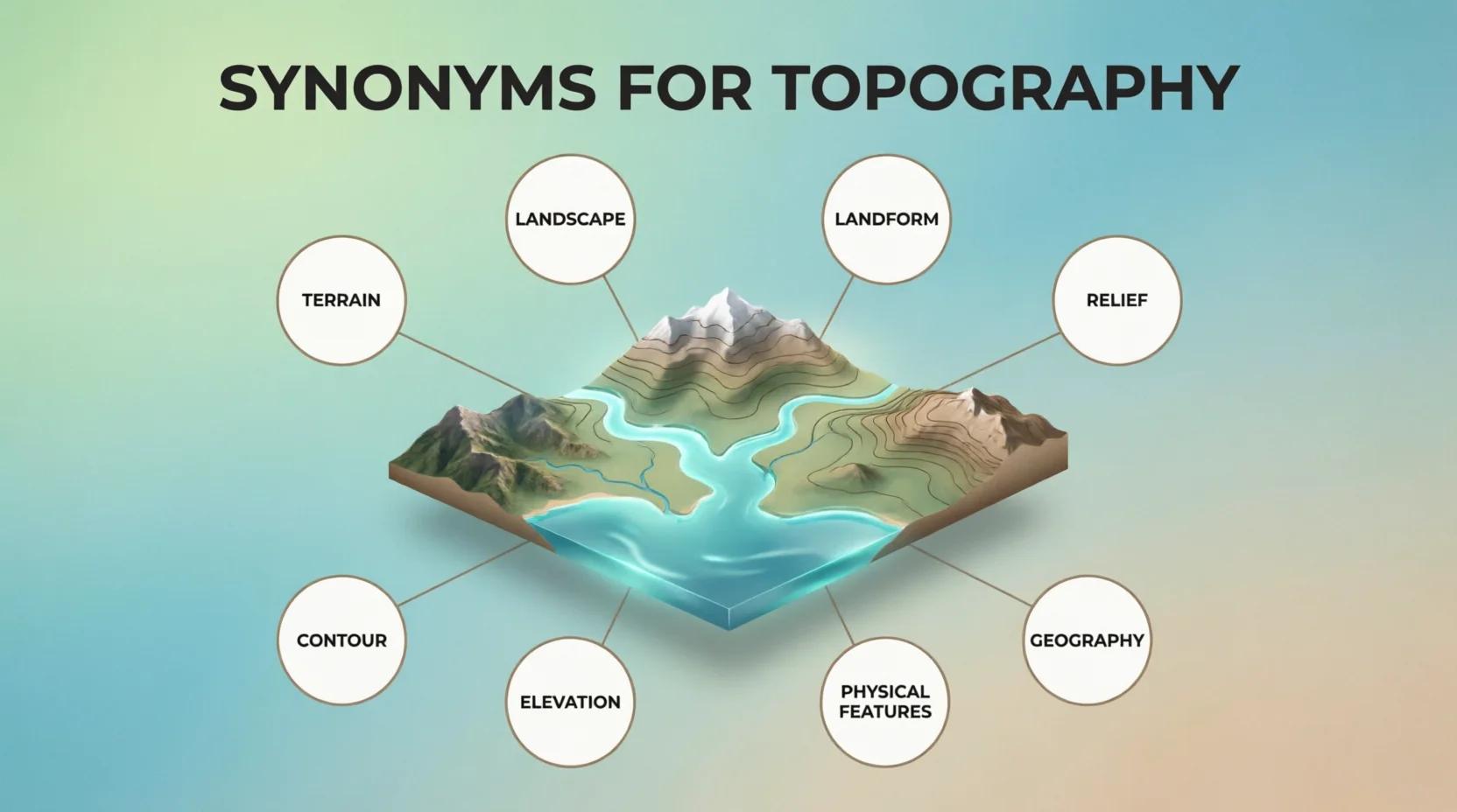
Topography describes the physical shape and features of land, including hills, valleys, slopes, mountains, and elevations.
Understanding synonyms for topography helps writers describe landscapes clearly while avoiding repetition in articles, essays, and reports.
Common alternatives include terrain, landscape, geography, landform, relief, and surface features, depending on the context and meaning.
These related words make descriptions more natural, precise, and engaging for students, writers, researchers, and English learners.
1. Terrain
Meaning: Terrain means the type and shape of land in a place.
Examples:
- The hikers crossed rough terrain.
- This terrain is difficult to walk on.
2. Landscape
Meaning: Landscape means the visible features and appearance of an area of land.
Examples:
- The mountain landscape looked beautiful.
- We enjoyed the green landscape during our trip.
3. Landform
Meaning: A landform is a natural feature of the Earth’s surface.
Examples:
- A valley is a common landform.
- The guide explained each landform on the map.
4. Relief
Meaning: Relief describes the differences in height and shape across an area of land.
Examples:
- The map shows the relief of the region.
- High relief makes the area look very uneven.
5. Geography
Meaning: Geography is the study of Earth, its places, and its physical features.
Examples:
- We studied the geography of the country.
- Geography helped us understand the mountain region.
6. Physical Geography
Meaning: Physical geography studies natural features and processes on Earth.
Examples:
- She enjoys learning about physical geography.
- Physical geography explains how valleys and mountains form.
7. Land Surface
Meaning: Land surface means the outer part of the ground in a particular area.
Examples:
- The land surface became uneven near the hills.
- Scientists studied the land surface after the storm.
8. Ground
Meaning: Ground means the solid land beneath our feet.
Examples:
- The ground rises sharply near the mountain.
- We walked across rocky ground.
9. Region
Meaning: A region is a particular area with its own natural or human features.
Examples:
- The region has many tall mountains.
- Farmers know the region’s land very well.
10. Area
Meaning: An area is a particular part or section of land.
Examples:
- This area has several deep valleys.
- The map covers a large area.
11. Topographic Features
Meaning: Topographic features are natural shapes and parts of the land.
Examples:
- The map shows several topographic features.
- Hills are important topographic features in this region.
12. Land Features
Meaning: Land features are the natural shapes and parts found on the Earth’s surface.
Examples:
- The teacher pointed out the land features.
- The island has many unusual land features.
13. Landform Pattern
Meaning: A landform pattern is the way different landforms are arranged in an area.
Examples:
- The landform pattern changes near the coast.
- Scientists studied the area’s landform pattern.
14. Elevation
Meaning: Elevation is the height of land above sea level.
Examples:
- The town has a high elevation.
- We checked the elevation before climbing.
15. Altitude
Meaning: Altitude is the height of a place above sea level or the ground.
Examples:
- The village has a high altitude.
- The pilot checked the altitude carefully.
16. Contours
Meaning: Contours are lines on a map that show areas with the same height.
Examples:
- The map uses contours to show the hills.
- Closely spaced contours indicate steep land.
17. Contour Map
Meaning: A contour map shows the height and shape of land using lines.
Examples:
- The students studied a contour map.
- A contour map helped us understand the valley.
18. Relief Map
Meaning: A relief map shows the height and shape of land in a visual way.
Examples:
- We used a relief map in geography class.
- The relief map clearly showed the mountain range.
19. Terrain Profile
Meaning: A terrain profile shows how the height of land changes across a distance.
Examples:
- The engineer checked the terrain profile.
- The terrain profile showed a steep hill ahead.
20. Land Configuration
Meaning: Land configuration means the way land is shaped and arranged.
Examples:
- The land configuration affects road building.
- Engineers studied the area’s land configuration.
21. Land Structure
Meaning: Land structure describes the physical arrangement and shape of an area.
Examples:
- The land structure is complex near the mountains.
- The team examined the land structure before construction.
22. Physical Features
Meaning: Physical features are natural parts of Earth’s surface.
Examples:
- Mountains are important physical features.
- The lesson covered the area’s physical features.
23. Natural Features
Meaning: Natural features are parts of the land that form naturally.
Examples:
- The park has many natural features.
- Rivers and hills are common natural features.
24. Mountain Relief
Meaning: Mountain relief describes the differences in height and shape in a mountainous area.
Examples:
- The map shows strong mountain relief.
- Mountain relief makes travel more difficult.
25. Terrain Structure
Meaning: Terrain structure describes how the land is shaped and arranged.
Examples:
- The terrain structure changes near the river.
- Builders studied the terrain structure first.
26. Surface Form
Meaning: Surface form means the shape and appearance of the land’s surface.
Examples:
- The surface form changes across the region.
- The study focused on the area’s surface form.
27. Land Morphology
Meaning: Land morphology describes the shape and form of land features.
Examples:
- Researchers examined the land morphology.
- The river changed the land morphology over time.
28. Physiography
Meaning: Physiography is the study or description of the natural physical features of an area.
Examples:
- The book explains the physiography of the region.
- Students learned about the area’s physiography.
29. Physical Landscape
Meaning: A physical landscape is the natural shape and appearance of an area.
Examples:
- The physical landscape includes hills and rivers.
- We photographed the beautiful physical landscape.
30. Land Profile
Meaning: A land profile shows the shape and height of land across an area.
Examples:
- The survey showed the land profile.
- The land profile helped planners choose the road route.
Conclusion
Learning synonyms for topography gives you more ways to describe land and physical features. Words such as terrain, landscape, landform, relief, and elevation can make your writing clearer and more varied. Students can use them in geography essays, while bloggers and content writers can create richer descriptions. Daily English users can also practice these words in conversations and emails. Try using a few new terms each day to build stronger vocabulary and communication skills.